Research project — seeking funding
Cannabis Factory Finder
A machine learning research project to detect illegal cannabis factories from commercial infrared satellite imagery.
Cannabis Factory Finder is an independent research project investigating whether machine learning applied to commercially sourced infrared satellite imagery can support the identification of residential and commercial properties used as illegal cannabis factories in the United Kingdom. This project is in a preparatory phase and is actively seeking research grants, innovation funding, and academic collaboration to develop, validate, and document its methodological framework prior to any fieldwork.
Cannabis Factory Finder is a proposed machine learning research project addressing a persistent public-safety problem: the identification of illegal cannabis factories operating within residential and commercial properties across the United Kingdom.
In UK law-enforcement and community-safety contexts, a cannabis factory typically denotes a property converted for large-scale illegal cultivation, often involving high-intensity artificial lighting, ventilation systems, and unauthorised electrical installations. These sites are associated with fire risk, structural damage, neighbourhood harm, and links to organised criminal networks. Despite sustained enforcement activity, detection frequently depends on reactive intelligence, neighbour reports, and resource-intensive ground investigation rather than systematic geospatial screening.
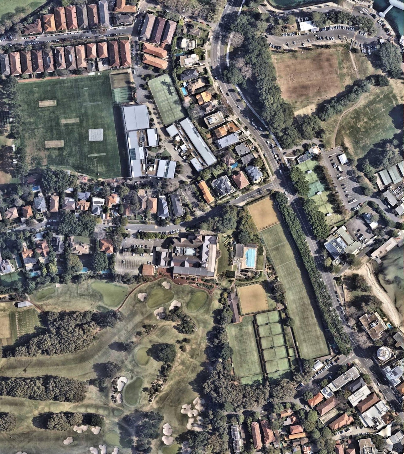
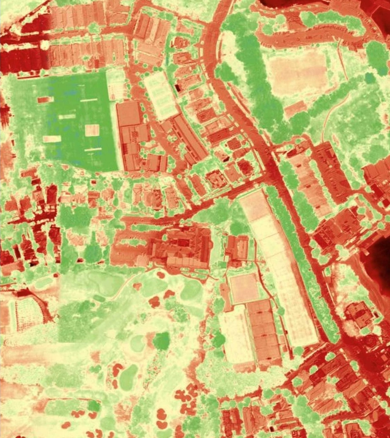
This research project contends that a significant methodological gap exists between the availability of high-fidelity commercial Earth-observation data and its application to cannabis factory identification at scale. Infrared and thermal satellite imagery can reveal heat anomalies not visible in standard photography, while advances in machine learning image recognition offer a means to analyse such data across large geographical areas with reproducible, auditable methods.
Cannabis Factory Finder therefore proposes to investigate whether supervised machine learning models, trained on verified thermal signatures associated with cannabis factory operations, can improve the accuracy and efficiency of large-scale screening compared with conventional approaches. The research is explicitly positioned as pre-commencement: no operational deployment, field validation, or law-enforcement reporting is claimed at this stage. The immediate objective is to secure funding to commence structured research activity under appropriate academic and ethical standards.
Pending commencement of funded research, this project is structured around the following primary research questions. These questions are intended to guide study design, machine learning model development, and subsequent evaluation and dissemination.
- Can machine learning models reliably distinguish thermal signatures consistent with illegal cannabis factory activity from other residential and commercial heat anomalies in commercially sourced infrared satellite imagery?
- What minimum spatial resolution, spectral characteristics, and revisit frequency are required for cannabis factory detection using supervised machine learning at urban and suburban scales in the United Kingdom?
- How do precision, recall, and false positive rates for cannabis factory screening vary across different machine learning architectures, training datasets, and geographical contexts?
- What governance, data-protection, and ethical safeguards are required before any research outputs from this project could be considered for operational translation by public-sector partners?
The overarching aim of this research project is to develop and empirically evaluate a machine learning methodology for identifying properties exhibiting thermal signatures consistent with illegal cannabis factory operations, using commercially sourced infrared satellite imagery. Specific objectives include:
- Establish a curated research dataset of infrared satellite imagery and verified reference cases suitable for supervised machine learning training and validation
- Design, train, and compare machine learning models for cannabis factory detection, with explicit documentation of architecture, hyperparameters, and performance metrics
- Develop an iterative model refinement protocol that reduces false positive rates as additional labelled data becomes available
- Evaluate the scalability and cost-effectiveness of geospatial machine learning screening across representative UK urban and suburban areas
- Produce a peer-reviewable research report and methodological documentation suitable for academic dissemination and funder reporting
- Define ethical, legal, and governance requirements for any future consideration of operational use, should research findings warrant further development
This research project proposes a phased methodological framework to be implemented upon award of funding. Each phase is designed to produce auditable outputs consistent with academic research standards and reproducible machine learning practice.
Phase 1: Data acquisition & curation
Procurement and systematic cataloguing of commercially sourced infrared and near-infrared satellite imagery from established Earth-observation providers. Attention will be given to spatial resolution, atmospheric correction, metadata standards, and alignment with visible-spectrum baselines for the same geographical areas.
Phase 2: Machine learning model development
Design and training of supervised machine learning and neural network architectures to analyse thermal imagery and classify heat patterns associated with cannabis factory equipment. Model selection will be guided by cross-validation, with comparison of at least two architectural approaches where feasible.
Phase 3: Validation & error analysis
Systematic evaluation against held-out datasets, with reporting of precision, recall, F1 score, and false positive rates. Error analysis will examine failure modes — for example, confounding heat sources such as industrial plant, data centres, or seasonal variation — to inform model limitations.
Phase 4: Reporting & dissemination
Compilation of research findings into a methodological report structured for peer review, funder reporting, and knowledge exchange with academic and public-sector audiences. Reproducibility documentation will accompany any published machine learning artefacts, subject to data-licensing constraints.
Planned data sources & compute environments
The research design anticipates use of commercially available satellite imagery (including providers such as BlackSky, Maxar/DigitalGlobe, GHGSat, and Planet Labs) and cloud-based machine learning infrastructure (including Amazon Web Services and Google Cloud). Dataset licensing, compute provisioning, and reproducibility tooling will be finalised upon commencement of the funded research project.
Proposed research phases
The following phases are indicative and subject to revision upon funding award and ethical review. No fieldwork or operational deployment is scheduled during the preparatory period.
- Phase 0 (current): Research project development, funding applications, and academic collaboration outreach
- Phase 1: Data procurement, literature review, and research protocol finalisation
- Phase 2: Machine learning model development and initial training
- Phase 3: Validation, error analysis, and methodological refinement
- Phase 4: Research reporting, dissemination, and assessment of pathways to further study
As an academic research project, Cannabis Factory Finder is committed to conducting future research activity within clearly defined ethical, legal, and methodological boundaries. The following principles will govern study design upon funding award.
Scope & limitations
This research project addresses property-level thermal screening at a geospatial scale. It does not propose covert surveillance of individuals, real-time tracking, or automated enforcement action. Any machine learning outputs would constitute research artefacts requiring independent validation before consideration for operational use. The project does not claim existing deployment, police partnerships, or validated detection performance at this stage.
Data governance
Commercial satellite imagery will be procured and processed in accordance with provider licensing terms and applicable UK data-protection legislation. Personal data will not be sought as a research input. Where reference cases are used for supervised machine learning training, data handling protocols will be established to minimise identifiability and restrict use to defined research purposes.
Ethical oversight
Prior to commencement of funded fieldwork or use of sensitive reference data, the research project will seek appropriate ethical review and establish governance arrangements proportionate to the study's methods and intended outputs. A clear distinction will be maintained between academic research findings and any future operational translation.
Subject to successful funding and completion of the research project, anticipated outputs include:
- A peer-reviewable methodological framework for machine learning-based cannabis factory detection from infrared satellite imagery
- Validated machine learning models with documented performance characteristics, limitations, and failure-mode analysis
- Evidence on the cost-effectiveness of combining commercially available infrared satellite data with machine learning for large-scale geospatial screening
- Reproducibility documentation and, where licensing permits, shared methodological artefacts to support further academic study
- Recommendations on governance requirements for any future operational translation, should research findings warrant further development
Dissemination
Research outputs will be disseminated through channels appropriate to an academic research project of this type, including funder reporting, conference presentation, and submission to peer-reviewed journals in relevant fields such as geospatial analytics, machine learning, and public-safety research. Summary findings will also be made available on this website following completion of funded research activity.
Societal impact
The potential societal value of this research project lies in its contribution to evidence-based approaches to cannabis factory identification — supporting earlier awareness of properties exhibiting elevated risk profiles, and informing more efficient allocation of limited enforcement resources. By developing machine learning methods under rigorous academic standards, the project aims to advance knowledge in a domain where systematic geospatial analysis remains under-explored.
We welcome enquiries from research councils, innovation grant programmes, charitable foundations, and academic partners interested in funding or collaborating on this cannabis factory detection research project. Whether you are assessing fit against your funding priorities or exploring joint study design in machine learning, remote sensing, or public-safety research, please get in touch.